PAUL ANDERSON
an aussie abroad


Welcome!
Over the past two decades I’ve lived all around the globe, seizing every opportunity to travel and explore the outdoors. I’ve experienced some great adventures along the way and I’ve met some amazing people. It’s been an incredible journey, but I’m not planning to slow down anytime soon! Enjoy the site, and stay connected. – Paul

After a few days of constant travel, having a couple of days in Hunza to unwind has been a nice change. It was also our opportunity to meet the local team from Silk Route Expeditions, who would be coordinating everything during the Pakistan part of our trip:
Didar Ali – Owner & Guide
Muhammad Shifa – Owner & Guide
Professor Sher Baz – Cultural Guide & local school teacher
Nazrab – Head of Security & retired police chief for Gilgit-Baltistan region
Izhar – Assistant Guide & Shifa’s son
Ayaz – Assistant Guide
Today was a very “local” day, starting with a visit to a non-profit teaching girls computer skills like web design and online marketing – skills that they can then sell as a freelancer. After that we went to visit the Aga Khan school, a private school for girls which is very selective about taking in the best and brightest students. The school was set on a lovely campus, and it was a delightful opportunity to meet and talk with some of these ambitious young girls. Inspirational stuff!
We rounded off the morning with a visit to a local carpet factory set up by Didar, where natural-dyed traditional carpets wee being made by hand – it takes around four months to make a 5′ x 7′ rug! Lunch was taken at our local representative’s Didar Ali’s house surrounded by orchard trees on a steep hillside just out of town.
In the late afternoon we visited Baltit Fort which looms above Karimabad village. For around eight centuries this was the seat of power for the local Mir (ruler) until he moved down the hill to more comfortable digs in the mid-20th century. The building then fell into neglect, but it was painstakingly repaired and renovated over several years in the 1990s and now looks as it did in its prime. It must have been quite a sight when the British army entered the valley in 1891!
It was a steep walk up cobbled streets through the old village to the base of the fort, where we were met by the curator who led us on a tour of it which included a painfully long video of old photos of the building and supposedly notable/historic people in the valley. Following tea on the rooftop as the sun dipped down behind the mountain ridge, we went into the old dining hall where we were treated to a dinner of local specialties accompanied by local artists playing traditional music and some dancing. In many ways – the layout of the room, the mood lighting, the music – it reminded me of Marrakech in Morocco. Interestingly, all the entertainment was performed by men and we didn’t see a single women while we were there – in the Hunza culture women would only dance at a private family event or gathering.


Given the length of the journey and terrain we had to cover, we had broken up the bulk of the trip from China to Pakistan into two days. Our first night in Pakistan was spent in Passu, a small village by the KKH. The next morning we continued south down the road towards Hunza, our first real “destination” in Pakistan where we would spend a few days.
The drive from Passu took us past numerous villages and the occasional Indiana Jones-style cable suspension bridge over the river, rudimentary structures with some gaping gaps between the wooden boards. At one point we reached a section of the road in pretty bad shape because the snout of the Ghulkin Glacier has been inching downhill in recent years, bulldozing everything in its way. Quite eery peering up from the cars at the terminal moraine of boulders and dirty ice!
After an hour or so from Passu we reached the end of the road at Attabad Lake. In 2010 a monstrous landslide dragged down a sizable chunk of mountain and blocked the river, killing 19 people in a village which was buried/wiped out. There were two major consequences from this event. Firstly, the landslide took out the KKH and no traffic was able to get up or down the highway – this explained the lack of traffic and belching trucks on the highway, and our guide told us that since then the volume of traffic has been only around 5% of normal.
The other major consequence from the landslide is that it blocked the river, forming Attabad Lake in the months that followed. The Chinese are presently building a new road and extensive set of tunnels to bypass the lake and reopen the KKH, but for the time being (next year or two) the only way to continue down the valley is to use one of the boats now on the lake to ferry from one end to the other.
The boats plying the lake turned out to be some surprisingly large home-made timber structures, with two tractor engines mounted on planks out to the side and long propellers affixed to the shafts and a driver in the cockpit above the stern. We loaded on to one of the boats with our gear, and once the two engines were hand-cranked to start we were on our way.
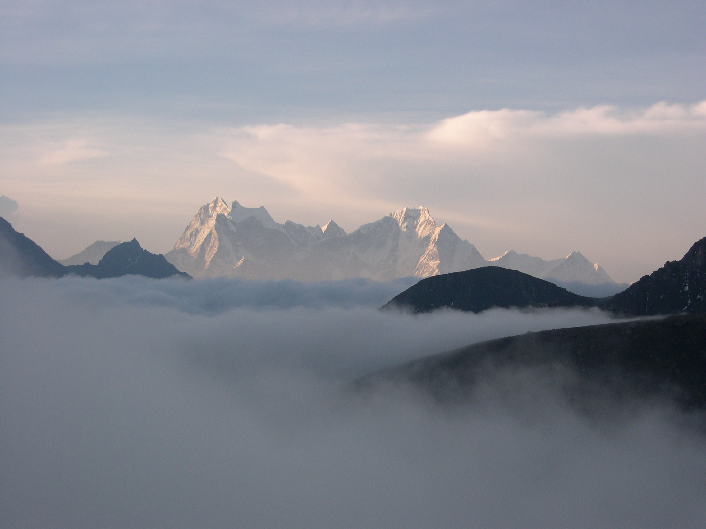
The first part of the boat trip was down a fairly rapid section of the river, and we were told the old KKH was about 100 feet below the waterline beneath us (extending to around 400 feet at its deepest point). The grey silty water if the river was soon replaced with quite brilliant turquoise water that took me back to some alpine lakes in Switzerland. The scenery for the next hour was spectacular, with the water color contrasted by the soaring cliffs and snow-capped peaks visible above the side valleys. For me, this was one of the highlights of the entire journey!
At the other end of the lake a makeshift harbor was in full swing, with boats being loaded and unloaded and bright, colorful Pakistani trucks waiting on the steep dirt tracks for their turn. I was able to rattle off a few quick photos but we were in a hurry to find the Toyota Land Cruisers we would be using for the remainder of our time in Pakistan. In a convoy of four vehicles we drove up over the enormous mound of rocks from the landslide blocking the valley and rejoined the old KKH just a few kilometers away from the upper end of the Hunza Valley and our hotel in Karimabad.


What a day! Today I achieved a long-time ambition of traveling over the Karakoram Highway from China to Pakistan, a dream I had since a guy called Christian (whose apartment I took over in Baden) first told me about it as he departed Switzerland to bicycle to Delhi via Central Asia and through the Karakoram.
The day started with the old army adage “hurry up and wait”. We headed over to the Chinese immigration and customs post in Tashkurgan straight after breakfast, but the Chinese officials were a little lazy coming in for work (blame it on the Mid-Autumn Festival festivities the night before – too much moon cake) and we were forced to wait out in the sun for a good hour and a half past opening time. The following hour and a half were a shining example of Chinese inefficiency and ineptitude, but by 1pm (Beijing time, 10am Pakistan time) we were back on the bus and awaiting our military escort to the border/pass. Due to the instability in nearby Afghanistan (accessible via the famous Wakhan corridor) and recent troubles with the Uighur in Xinjiang, it’s now impossible to travel independently over the Khunjerab Pass – to the disappointment of a French cyclist, who was forced to put his bike on the bus and travel that way rather than under his own power. We therefore had to wait for the other buses to be processed, and then traveled in convoy south towards the pass.
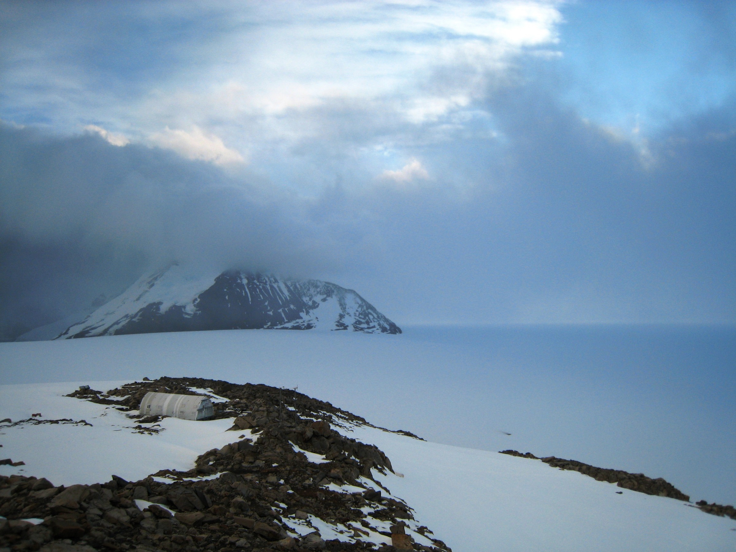
It’s a good 100+km from Tashkurgan to the Khunjerab Pass, through a wide valley flanked by the Karakoram and Pamir mountain ranges and dotted with rather bleak-looking Tajik villages and the odd yurt. The altitude rose gradually, and it was only just a couple of kilometers short of the pass that we hit a set of switchbacks. After a final security checkpoint at 4600m we were left on our own to drive the remaining distance to the Khunjerab Pass at 4730m! The thin air left us breathless but the views of snow-capped mountains and glaciers coming almost to the road more than made up for it. We spent a few minutes at the pass for the ubiquitous photos, and our Pakistani representatives were there to meet us.
The less-than-convincing Khunjerab Security Force (KSF) failed to meet us at the pass, so we began the descent down the Khunjerab by ourselves. It’s along this section of the KKH that the Chinese builders really earned their keep over the 20 years it took to construct this engineering marvel (at the expense of a life per kilometre!), as the road plunges down a frightful set of switchbacks and cuts into the cliff side high above the river below and with near vertical mountains above. We had to weave between minor rockfalls on the road, but all in all I was surprised by the good condition of it.
First stop was a KSF checkpoint, whee we had our first exposure to Pakistan bureaucracy which clearly follows the Indian and British Imperial model. With time to burn we had an impromptu tea party by the river, and after another hour or so we were on our way further down the valley to Sost to get our visas and clear customs – I won’t get into the details but you can imagine how that went, even when palms were greased with a ludicrous $150 per visa!
Near Sost we passed the rather sad roadside spectacle of a caged snow leopard. She had been found some 18 months ago as a cub abandoned in the river, and while the locals had plans for a conservation effort in the meantime this beautiful animal was being kept in less-than-ideal conditions. I was however curious to see this oh-so-rare animal, and I wasn’t disappointed: beautiful soft colorings, smaller than I thought, with a long bushy spotted tail about the length of the body.
We made it to Passu around sunset at 7pm pretty exhausted from the day’s travels, and after dinner and a beer to celebrate making it to Pakistan while looking across the river at the jagged ridge above us we headed to bed fairly early.


