
Denali Expedition Itinerary: West Buttress Route
I’ve been reading up more on the West Buttress route up Denali. I was looking for the full expedition experience and this route definitely seems to fit the bill – hauling gear to camps higher and higher up the mountain before attempting a summit push will be quite a challenge!
Here’s a day-to-day sample itinerary from the Alpine Ascents site:
Day 1: Morning meeting in Talkeetna. Meet at the Alpine Ascents office. After introductions, orientation and final gear check, we’ll board a ski-equipped aircraft and fly to Base Camp on the southeast fork of the Kahiltna Glacier (7,300 ft.). The flight to Base Camp is marvelous, presenting outstanding views of a variety of peaks, including Mt. Foraker, Mt. Hunter and Moose’s Tooth. Upon arrival, we’ll prepare our Base Camp. (Glacier travel review may be done on this day.)

Base camp on the Lower Kahiltna Glacier (Photo courtesy of SBNation.com)
Day 2: Glacier travel review. We’ll carry to our intermediary camp (approximately halfway to the traditional Camp I). This gives us a chance to get an easy start and let you sort out any adjustments in gear and sled-pulling setup. This is important, as we will be pulling sleds for the next eight days.
Day 3: Carry loads to Camp I (7,800 ft.). Snowshoes may be necessary between camps on the lower part of the mountain.

Camp I views of Denali (Photo courtesy of Voketab.com)
Day 4: Carry loads to cache between 9,800 and 10,000 ft. (Camp II) and return to Camp I. The route this day ascents a slope called “Ski Hill,” which flattens out as we approach Camp II.
Day 5: Our carry today depends on snow/weather conditions and how the group is feeling. We’ll either ascend back to our cache and camp for the night or continue on to 11,200 ft. (Camp III.) Camp III is located in a small cirque at the base of Motorcycle Hill.
Day 6: We’ll carry all our gear to Camp III.
Day 7: We’ll carry half our gear up Motorcycle and Squire Hill and then traverse a long gradually rising plateau to Windy Corner. We’ll continue on around this narrow corner for a few hundred yards to make a cache (at approximately 13,500 ft.) and return to Camp III. This day provides stunning panoramic views of the surrounding peaks and the northeast fork of Kahiltna Glacier, 4,000 feet below.
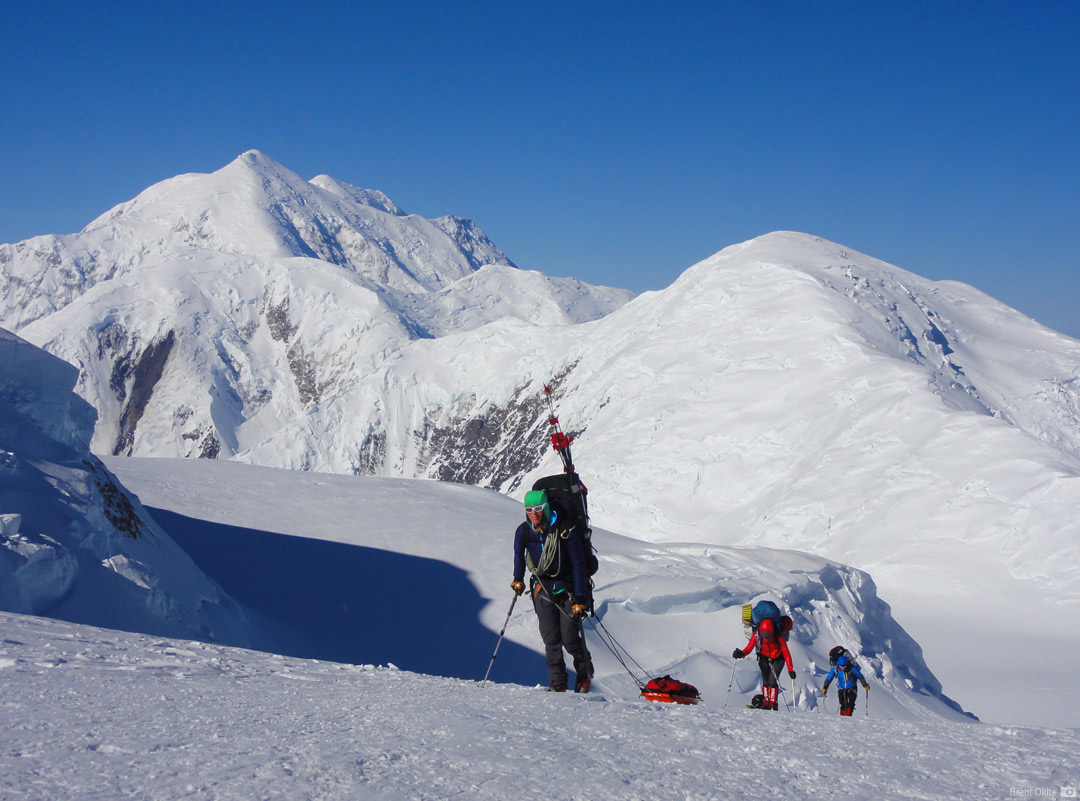
On Motorcycle Hill above 11K Camp (Photo courtesy of RMI Guides)
Day 8: Move to Camp IV (14,200 ft.).
Day 9: Descend to our cache at 13,500 ft. and carry to Camp IV. This is an easy day as we’ll descend 700 ft., pick up our gear, and return to Camp IV.
Day 10: We’ll carry loads to 16,500 ft. and return to Camp IV. From Camp III, we’ll ascend 1,100 ft. of moderate snow slopes to reach the beginning of the fixed lines. Using ascenders on the lines to self-belay, we’ll climb the Headwall, which consists of 900 feet of 45° to 50° snow and ice up to the crest of the West Buttress. From there, the climb takes on an entirely different nature with views that fall off in both directions several thousand feet below us.
Day 11: Rest Day at Camp IV.

View down to 14K camp from the 17K camp (Photo courtesy of RMI Guides)
Day 12: Carry and move to High Camp (Camp V, 17,200 ft.). We’ll again ascend the fixed lines and follow the exposed ridge 600 feet up around Washburn’s Tower, and on to Camp V, which we establish on a saddle just above the Rescue Gully. It overlooks Camp IV 3,000 feet below.
Day 13: Rest day. Rest and prepare for the summit attempt.
Day 14: Summit day. We traverse across a steep snow face to Denali Pass. From here, we’ll follow gentler slopes to reach Archdeacons Tower and a large plateau at 19,400 ft., known as the “football field.” From the plateau, we’ll ascend moderate terrain to the crest of the summit ridge, where we’ll look down upon the immense 8,000 ft. South Face, with Cassin Ridge and the South Buttress in full view. Once on the summit ridge, excitement grows as we’ll climb the last 300 feet to the top of North America. From the summit, we’ll have a 360° view of the entire Alaska Range, with Mt. Hunter and Mt. Huntington to the south and Mt. Foraker to the west. These peaks, along with scores of others, make this mountain view one of the most impressive in the world. After taking photos, we’ll descend to our High Camp.
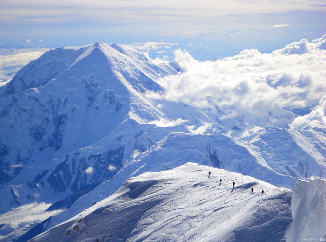
Climbers on the summit ridge (Photo courtesy of RMI Guides)
Days 15-16: Return to Base Camp. From High Camp, we spend two days returning to Base Camp, where we will board a plane and return to Talkeetna.
Days 17-21: Extra days, for inclement weather, rest and acclimatization as needed.
Pingback: Follow me on Denali! | PAUL ANDERSON